Overview
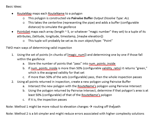
For this project, I helped configure the logic of the inspection algorithm with consideration to geoprocessing functions provided in ArcGIS Pro. The goal was to determine whether a pipeline inspection was valid based on an inspector's location as they traveled along a pipeline. If the inspector remained relatively on track, with consideration to some other parameters, the inspection was considered valid.
Logic Development
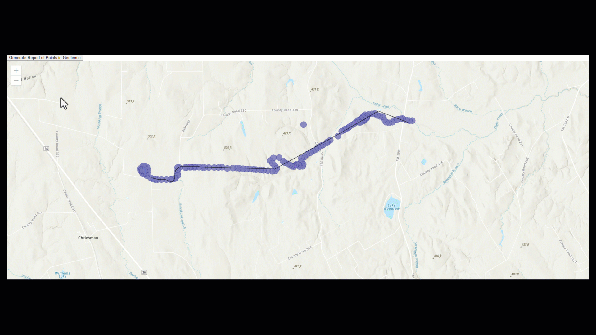
The client allowed a lot of freedom in developing a solution, so long as it followed a couple of provided parameters. This freedom meant that I had a lot of flexibility, but that I also had to infer some things on my own. For example: how do I determine if an inspector is “close enough” to the route? The easiest way to do this would be to create a geofence, which is bounded from the centerline from a certain configurable distance, equidistant from the right and left of the pipe. I could then make use of geometry.contains() in ArcGIS Pro to determine whether or not the inspector's location fell within that geofence. Here are some notes I made while constructing the logic for the program:
Word Document planning implementation methods
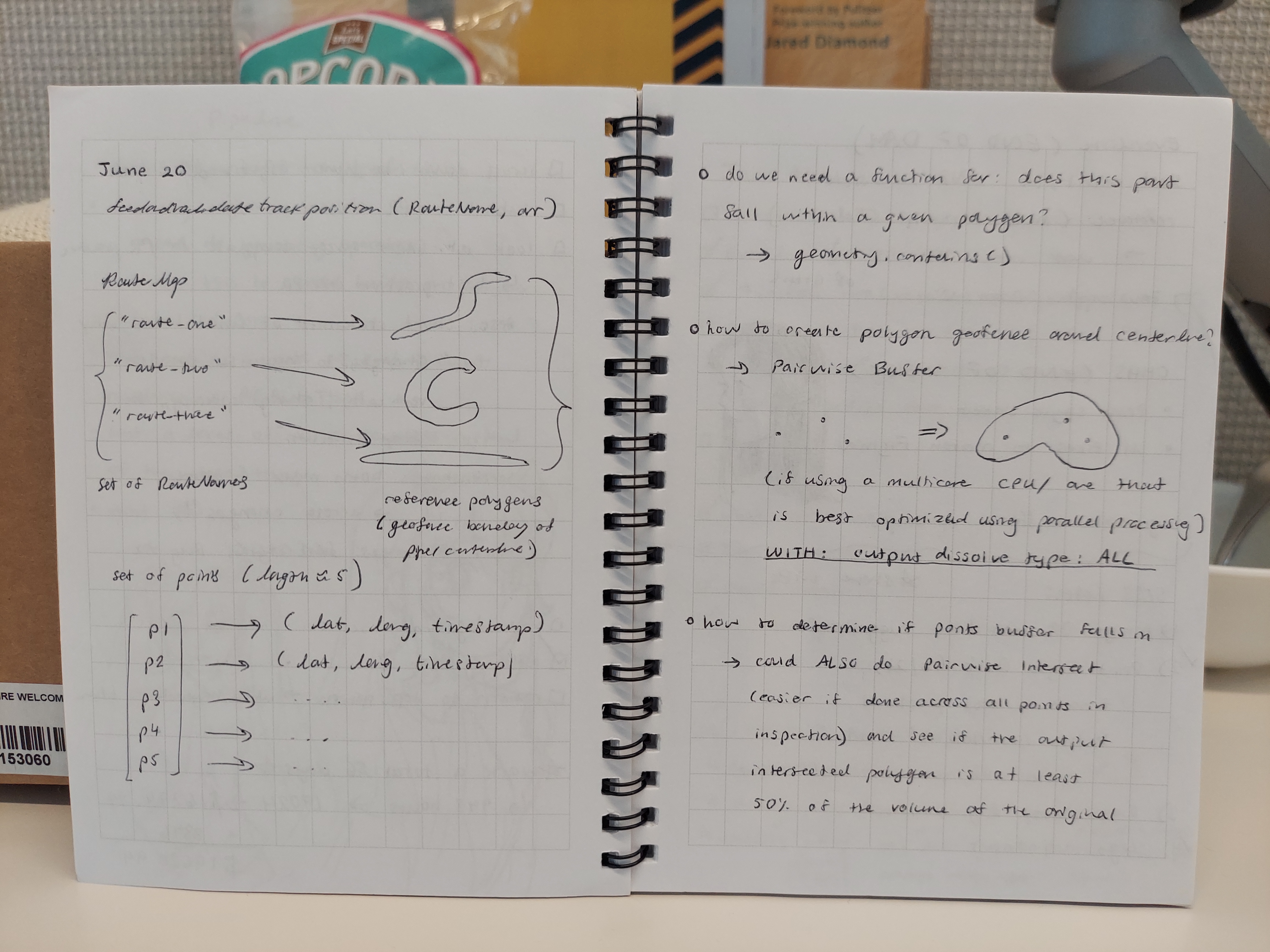
Jotting down thoughts on defining data structure, use of ArcGIS Pro geoprocessing tools
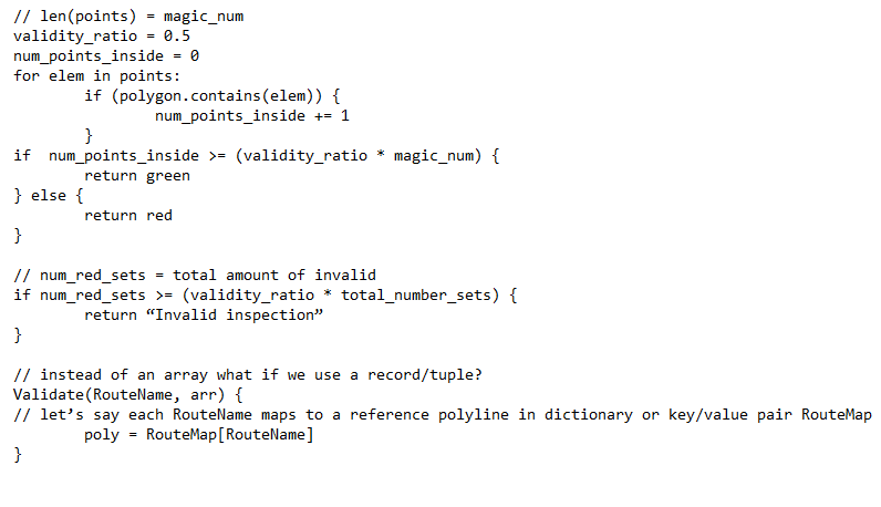
The following is a partial pseudocode implementation of Method #1
Some edge cases to consider were:
1) What if there was an obstacle in the way that affected the inspector’s path?
2) What if the inspector forgets to turn off the app? (dwell)
3) What if there are inaccuracies in the GPS data tracking inspector location?
1) What if there was an obstacle in the way that affected the inspector’s path?
2) What if the inspector forgets to turn off the app? (dwell)
3) What if there are inaccuracies in the GPS data tracking inspector location?
In case 1, obstacles could be determined over time if an inspector's path always fell outside the geofence in a certain pattern, at a certain location. Once obstacles are detected and confirmed, this will be accounted for when determining if the inspector's path was valid or not. Another approach would be to track the inspector's elevation as well (z-axis) which would be another indicator that there is some obstruction on the path. For case 2, we can turn off location and stop collecting data points after the inspector is a certain, configurable distance away from the end of the pipeline. This way a large amount of points falling outside the geofence doesn't affect the validity of the inspection. Regarding case 3, we can implement outlier detection and ensure the GPS technology used is standardized across all devices.
Implementation
Special thanks
Special thanks to JP Stupfel for being so helpful and resourceful during the implementation process! He had taken the liberty of working through both the client-side and server-side implementations in his own time which sped along the process of handing off the deliverable to the client.